At Last: Village and Residents Agree to a Stormwater Management Plan for Cayuga Pond
- Wednesday, 17 July 2013 16:21
- Last Updated: Wednesday, 17 July 2013 16:39
- Published: Wednesday, 17 July 2013 16:21
- Hits: 3716
 On Wednesday July 11th, the Scarsdale Board of Trustees and Robert DeGiorgio of Dvirka and Bartilucci Engineers met once again with residents to discuss, and hopefully agree upon a "modified modified" plan to mitigate the stormwater issues in the Fenway Golf Club Area.
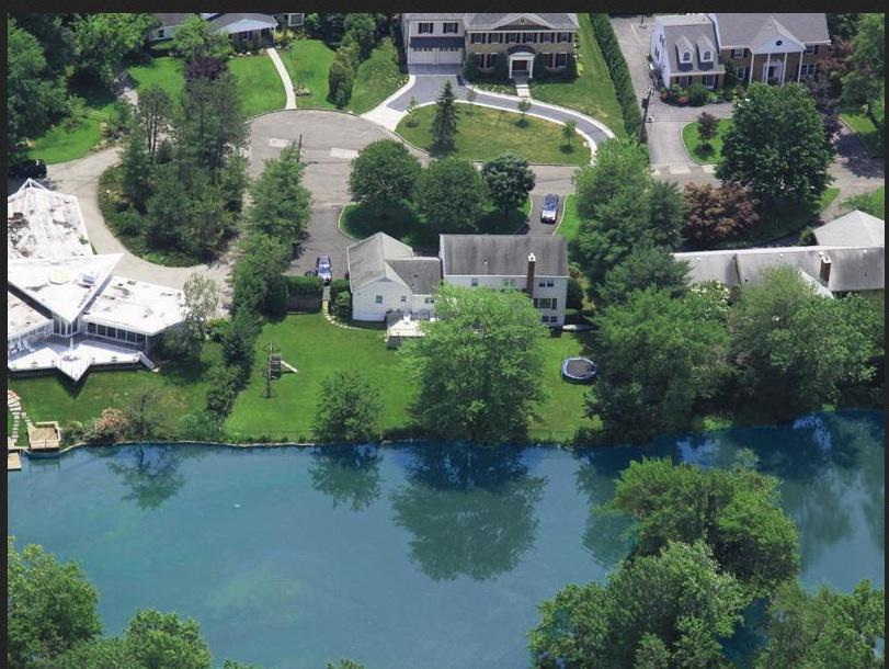
For those unenlightened, the Fenway Golf Club Area, or critical Sub-Drainage Area SR 3, has been deemed a FEMA flood hazard area. These flood areas are determined using statistical analyses of records of river flow, storm tides, rain fall, information obtained through consultation with the community, floodplain topographic surveys, and hydrologic and hydraulic analyses. Due to its particularly low elevation of 225 feet, all 271 acres of the Fenway area are deemed a flood plain. But some specific areas within SR 3, namely Canterbury and Cayuga Road, are particularly vulnerable to flooding issues because of their proximity to Cayuga Pond, which tends to overflow and flood during intense storm events.
During the most recent meeting between the Board of Trustees, D&B Engineers and the residents of this area, neighbors shared stories and pictures of their own personal battles with excess storm water, arguing over who had the highest water level in their basement, almost as if it were a contest. To someone who hasn't dealt with much flooding, I was dumbfounded when I heard that during the last intense storm event, two different residents each reported finding a snapping turtle in their basement. However, I was alone in my bewilderment. These residents are so accustomed to dealing with these flood issues that none were even fazed. Seconds later, another resident shared a picture of his backyard, which looked virtually identical to a swamp. Once again, I was alone in my enthrallment.
Despite their novelty to me, these flooding issues are certainly not breaking news, as the Village has been battling excess storm water since 2004, when they first retained engineers Dvirka and Bartilucci (D&B) following a Storm Water Drainage Condition Survey. Five years later, in 2009, D& B formulated the 2009 Comprehensive Storm water Management Plan, which proposed certain modifications to the current drainage structure. Since then, there have been dozens of alterations to these plans, particularly for the Fenway area.
During the previous meeting on May 14th, D&B proposed the "Modified Plan." This plan focused on improving water flow from Cayuga Pond into the open watercourses along Cayuga and Canterbury Roads to the culvert at Canterbury Road. The plan was for Cayuga Pond to be converted from a recreational pond into a storm water detention basin to manage excess storm water runoff. Another aspect of this modified plan was improvement of the culverts (drain pipes that allow water to flow under roads) on Cayuga and Canterbury Road. These improved culverts were meant to allow for better water flow and balance through the piping systems.
While this proposal seemed to show promise, much of the work involved needed to be implemented on private property and restrictive deeds and covenants obligate the homeowners to underwrite a portion of the project. In addition, some residents just simply did not agree with the logistics of the plan and felt it would not provide sufficient stormwater mitigation.
In response, the Village Board of Trustees decided to hold another meeting last Wednesday in hopes of reaching a consensus on the newest "Modified Modified Plan." Currently, the open watercourse is impacted with sediment accumulation that needs to be removed in order for the depth of water flow to be where it should be. There are 8 inches of pocket sandbars, which limits the capacity of the pipe to carry water at peak flows. This limits the ability of the system to drain significantly. So in order to increase the systems draining ability, the Village felt that the best option is to create an open channel, allowing water to flow in to the system on the opposite side of the road, as well as continue down the middle, thus creating a balancing effect. Currently, water on Canterbury Road takes a sharp 90-degree bend and enters a manhole, which is creating the water backup. By having water cut straight across the road with an open channel, you allow water to flow across the street and disperse more evenly in a more natural pattern. Simply put, there would be two paths for the water to flow, rather than one, thus giving the system capacity to receive more water. In addition, there will be a large grate spanning across Canterbury road, so one will actually be able to see inside the watercourse. This makes the system easy to inspect and clean out, which is important when considering the amount of sediment in the culverts. In addition, this plan involves Village engineers performing hydrostatic analysis on the system down stream to see if there is potential to capture some detention in the village owned property by the medical center.
An important distinction between this "Modified Modified Plan" and the previous "Modified Plan" is that this one deliberately does not involve private property. The village does not want to perform any structural modification to private homes because that would raise a plethora of new financial and legal issues. That could ultimately delay this process even further, and it could take another two years before any changes are made. To avoid this, the village plans to work solely on public infrastructure, curb line to curb line, within their right of way. Despite various concerns and differing opinions, everyone agreed to move ahead with this project, which is expected to begin next spring.
While everyone was relieved to reach a consensus, which was necessary in order to get construction started by spring, many residents remain cautious and concerned. They are happy that SOMETHING is finally being done to mitigate flooding in their neighborhood, but many wonder if that something is enough.
With these modifications, the system should be able to withstand a mild storm that produces about 3-3.5 inches of rain, without any major flooding issues. However, residents are still concerned about larger storm events. The Village recognized this concern, stating that they do anticipate positive results with moderate storm events, but realize that large storm events (which produce 6+ inches of rain) will likely still cause some flooding.
With the looming threat of continued flooding from large storms, residents were anxious to expand this project to private property in order to increase their homes defense against flooding. Some residents were willing to spearhead working with the village to have all residents private streambeds cleaned out, which would make a big difference in terms of peak water elevation and flow. Keeping them clean on a regular basis would help immensely in terms of flooding. The village stated that they would gladly work with all the homeowners to come up with a plan like this in the near future. But as for right now, they feel that this modified modified plan is holistically positive for the entire watershed and will yield a massive improvement because the improved flow won't allow a for a backup of water.