


Proposed NYS Congressional Maps Look Very Similar to Former Maps
- Sunday, 18 February 2024 13:49
- Last Updated: Sunday, 18 February 2024 13:58
- Published: Sunday, 18 February 2024 13:49
- Joanne Wallenstein
- Hits: 1234
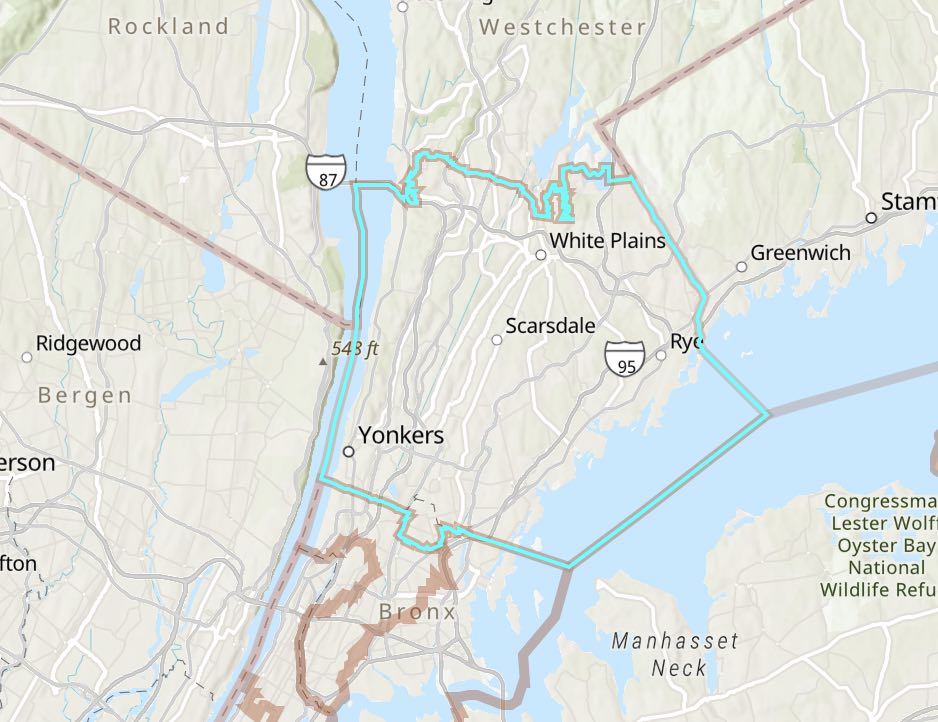 The long awaited redistricting map of New York’s congressional districts was released by the NYS Independent Redistricting Commission this week. The news is that it looks much like the former map that was drawn by a court appointed special master and used for the 2022 election. You can see the new map here. If this new map is passed by the NYS Legislature, Scarsdale will continue to be in Congressional District 16, now represented by Jamaal Bowman. However that seat is currently being challenged by Westchester County Executive George Latimer and many were awaiting the new map to see how it might affect the outcome of the primary challenge.
Commenting on the new map, Latimer said, “This is only the next step in a long process; it is now in the hands of the legislature, and we are confident in the ability of Majority Leader Stewart-Cousins and Speaker Heastie to complete this process fully and fairly. Regardless of the timing or the ultimate disposition of the lines, we look forward to continuing to bring our message of progressive results that benefit the people of our area, in whatever neighborhood they live and in whatever jurisdictions are ultimately assigned to CD-16.”
Here is an explanation of the recent history of redistricting in New York State:
Redistricting happens every 10 years after each census. The 2020 census triggered many changes in New York due to population changes throughout the state and the loss of one congressional district. After a contentious redistricting process, the NYS Assembly and NYS Senate maps for the 2024 elections have been settled. However, the Congressional map has not been finalized. New York State is critical as we have 26 seats in the House of Representatives and several competitive districts. This is why what happened yesterday is so important.
After the 2020 census, the New York State Independent Redistricting Commission (IRC) was formed to draw a new Congressional map for NYS. The IRC was not able to agree on a single map and submitted 2 competing maps. These maps were then rejected by the Legislature. The IRC had a constitutional duty to submit a new map proposal but did not do so. As a result, the State Legislature drew its own map.
The map passed by the State Legislature was challenged in court and deemed unconstitutional. The Courts determined that because the IRC had not proposed a second map after its first set of maps were rejected, the Legislature did not have the authority to introduce and pass its own map. A court-appointed special master then drew the Congressional map that was used for the 2022 elections. Following those elections, the New York State Court of Appeals ruled in late 2023 that the maps used for those elections were not permanent, and the IRC should send a second Congressional map proposal to the Legislature.
On February 15, the IRC met in Albany and voted to send a new Congressional map to the State Legislature. Unlike two years ago, the Commissioners were able to agree on a single proposal, which passed by a nine to one vote. That map must now be voted on by both houses of the State Legislature and, if approved, be signed into law by the Governor. If the State Legislature rejects the IRC proposal, or if the Governor vetoes the proposal, then the State Legislature may, with certain legal limitations, amend the rejected map and pass its own Congressional map.
For most districts, the Congressional map proposed by the IRC is similar to the existing, special master drawn map. For Westchester’s two Congressional districts (CD-16 and CD-17), the IRC proposal makes no changes within Westchester County. The proposed CD-16 is identical to the existing district, and the only changes to CD-17 are minor adjustments within the Town of Beekman in Dutchess County. Statewide, the most significant changes are to Congressional Districts 18, 19, and 22.